
Find Nassau County Streets by Address
A Nassau County street search works best as a parcel trail, not as a list of names. Begin with the address as printed, then try the official municipality and ZIP separately. The county warns users of its Land Records Viewer to omit directional prefixes and street suffixes from the street-name field. Keep the original spelling in notes, because a historic directory, plat, or map may use a different form. The result is a better starting point for a street directory search and avoids treating a postal community name as a legal jurisdiction.
- Enter the house number, street name, town, and ZIP in the Nassau Land Records Viewer, or use the Section, Block, and Lot fields when those are known.
- Save the parcel's SBL, or Section, Block, and Lot, plus its situs address and municipal fields. An SBL is the stable parcel key that can survive a confusing street label.
- Open the Nassau GIS parcel viewer and inspect Parcels, Lots, Road Annotation, and boundary layers along the road.
- Use the owner, legal description, and recording references to search the County Clerk's deed records. Confirm the lot and subdivision before treating a recorded party as tied to the same address.
- For an older household question, compare the address with a reverse directory or criss-cross volume. The state voter lookup is a personal match tool, not a Nassau County street roster.
That sequence keeps ownership, parcel geography, and historical occupancy separate. It also gives a useful fallback when a street number belongs to a condominium, a split lot, or a parcel whose common address has changed.
Nassau County Land Records Viewer
The Nassau County Department of Assessment uses the Land Records Viewer, often called LRV, for the public assessment roll. Its address route leads to tax maps, district information, parcel photographs, tax history, exemptions, comparable sales, and GIS context. It is a property record, not a household roster. The visible form accepts address and SBL inputs, while the assessment office can provide an official property card when mailing or ownership detail is needed.
| LRV field | Input | Use in a Nassau County search |
|---|---|---|
| Section, Block, Lot | Text fields | Search the official SBL parcel key. |
| House Number | Text field | Start an address-based parcel search. |
| Name of Street | Text field | Enter the road name without directions or suffixes. |
| Town and ZIP | Address fields | Narrow the locality without treating ZIP as a boundary. |
| Search and Clear | Buttons | Run or reset the parcel form; CAPTCHA or an account can affect access. |
The Assessment Department is at 240 Old Country Road in Mineola and lists weekday hours of 8:00 to 4:30. Its assessment cards distinguish the situs, the physical parcel location, from the mailing address used for correspondence. A mailing field can point elsewhere and does not establish that a named person occupies the Nassau County parcel.
Note: An owner-name capability is described in assessment material, but the inspected public LRV form did not display an owner-name field.
Nassau County Address Record Clues
The Nassau assessment search shows the address-first form used to connect a street number with an SBL. A returned parcel can also show property class, values, taxes, exemptions, recent sales, and a liber and page reference where available.
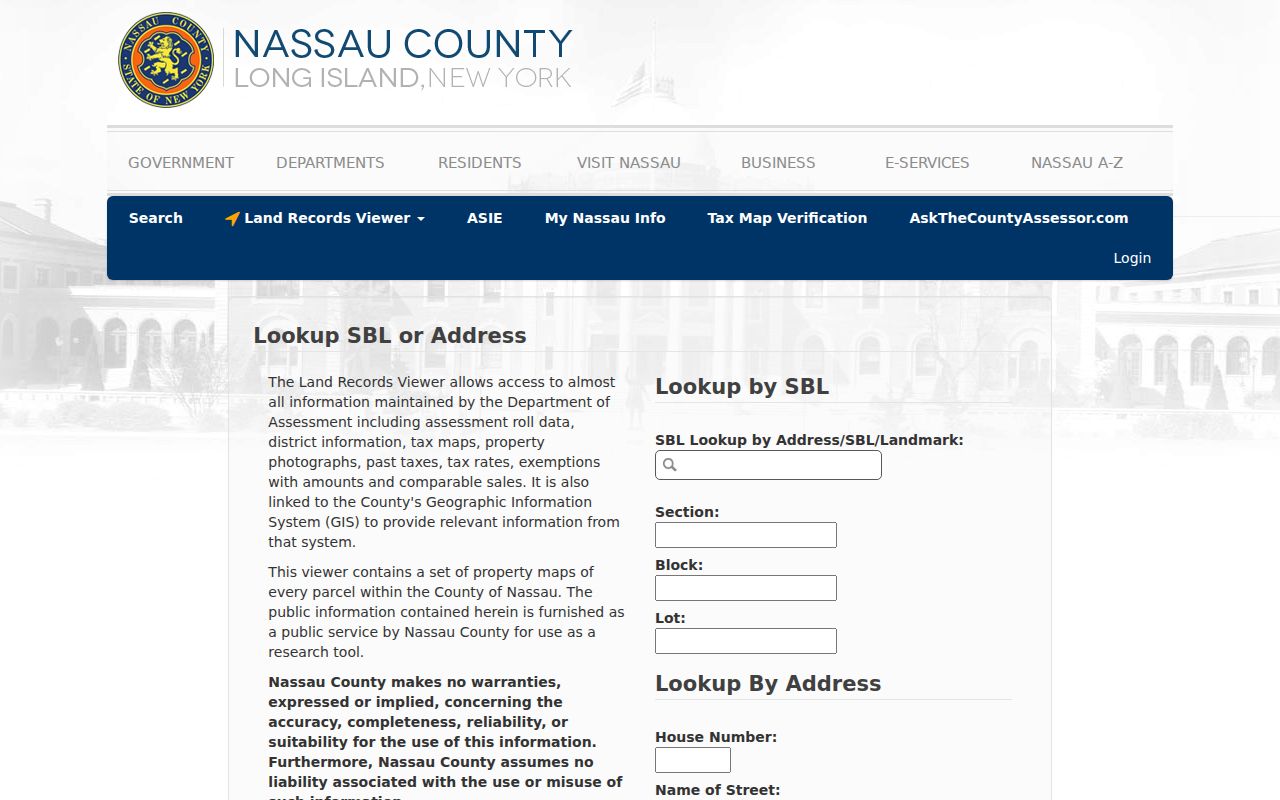
Use the result as a record locator. The SBL and legal reference are more reliable bridges to deed and map records than a street number alone.
Nassau County GIS Street Layers
A street directory search gains geographic context in the Nassau County GIS viewer. Search by Address locates the target, then the Parcels and Lots layers show the property geometry. Road Annotation, Major Roadway, Railroad, City, Village, Unincorporated Area, and Place Boundaries help separate a familiar road name from the government unit that holds the file. The viewer also offers aerial, topographic, FEMA, Nassau 1926, Nassau 1950, and selected New York aerial layers.
Use the map's Identify, Location, Distance, and Area tools to understand a road segment, then return to the parcel record for names and values. The GIS map does not publish an occupant list. Its purpose in a Nassau County street directory workflow is to connect addresses, adjacent lots, and boundary context without guessing from the map label.
The Nassau GIS parcel viewer exposes the road and parcel controls used for that comparison.
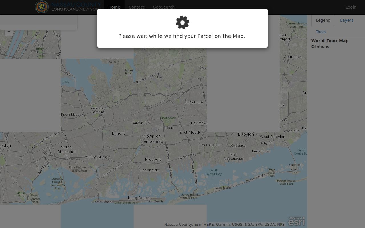
Historic overlays can help test an old road label, but they should be paired with an SBL, plat, or dated record before an address link is treated as certain.
Nassau County Street Record Routes
Several Nassau County records can be reached from a street address, but they do not prove the same thing. Assessment data is strongest for the parcel and its tax context. The Clerk's index is strongest for a recorded transfer. A municipal permit can date a project. A library volume may place an occupant at an address in a particular year. Keeping the source purpose in view prevents an address chain from becoming a false current-residence claim.
| Address record | Nassau County custodian | What it can establish | Access route |
|---|---|---|---|
| Assessment roll or card | Department of Assessment | SBL, situs, available owner or mailing detail, taxes, values | LRV, office card, or copy request |
| GIS parcel layers | Nassau GIS | Parcel geometry, roads, boundaries, historic overlays | Public map and layer controls |
| Deed index and images | Nassau County Clerk | Grantor, grantee, instrument, date, book or page, legal description | Free search; paid images or counter copies |
| Plat or subdivision map | Nassau County Clerk | Lot, block, subdivision, road layout | Map room or copy request |
| Permit or code file | City, town, or village | Addressed work, project, inspection, or date | Local portal, counter, or FOIL request |
| Criss-cross directory | Library of Congress or local collection | Historic address-to-occupant entry | Onsite or volume-dependent access |
The state voter lookup is not in this table as a street-browse route. It requires a registered voter's name, date of birth, county, ZIP, and address information. Election Law §3-103(5) limits voter-file use to election purposes, and confidential addresses remain protected.
Nassau County SBLs and Deeds
Move from the Nassau County parcel page to the County Clerk only after saving the SBL and legal description. A deed's parties are grantor and grantee: the grantor transfers an interest and the grantee receives it. The legal description identifies the land in the recorded instrument. It is often more precise than the posted street number, especially for a subdivision, combined lots, or a condominium.
- Parcel
- A defined piece of land represented in the assessment and GIS records.
- Situs address
- The physical location of the parcel, distinct from an owner mailing address.
- Plat
- A recorded map that shows the subdivision or lot layout tied to a legal description.
- Criss-cross directory
- A reverse address directory arranged by street and house number rather than by personal name.
The historic Nassau County Official Records repository offers direct and reverse index books, deed records, plat books, record types, and year fields. It covers historic official records from 1840 through 1982. The current Official Records system has free searches and document images from February 22, 1994 forward, while older material is added periodically. A gap between screens can mean a different repository or an office search, not a gap in the record itself.
Current image downloads cost $0.65 per page, and printed search results cost $1.50 per page according to the Clerk's procedure. Certified copies are obtained from the Clerk and are official copies, not an independent determination of ownership.
Nassau County Street Jurisdiction Checks
A Nassau County street name can cross a city, village, town, or unincorporated-area boundary while the postal name remains familiar. Nassau has three towns and two cities, with villages within towns. Mineola illustrates the overlap: it is the county seat and also a village in the Town of Hempstead. A ZIP or post-office community therefore cannot identify the permit office, school district, village, or assessment field by itself.
Great Neck is another useful check. Its official profile groups ZIPs 11020 through 11024, while several villages and community labels sit in the same North Hempstead area. Coastal addresses create similar splits around Long Beach, Island Park, Atlantic Beach, Lido Beach, and Point Lookout. Search the street directory with the municipality shown by GIS or the assessment record, then verify a specific delivery address with USPS if a postal question matters.
Nassau County Permits by Address
Permit and code records can add a dated event to a Nassau County address trail, such as construction, an addition, demolition, inspection, or a subdivision-related approval. The custodian is normally the relevant city, town, or village. Nassau County does not provide one universal permit search. Start with the municipality confirmed by the LRV and GIS records, then ask whether the file is online, held at a counter, or available through a Freedom of Information Law request.
North Hempstead is a concrete limit. Its reviewed procedure lets owners see their own submitted applications, but prior-owner permit files require a FOIL request and a records-room appointment. The Nassau County Health Department also has realty and sewage records that can be requested by SBL, street, community, or subdivision details. Those files may date an approval or project; they are not resident rolls.
Note: Ask for the address, SBL, project date, and document type when requesting a municipal file, because a street name alone may retrieve the wrong property.
Nassau County Reverse Directory Trail
The historical layer of a Nassau County street directory is address-first. The Library of Congress lists Nassau criss-cross directories for 1972 through 2007. Those volumes arrange entries by street and house number, which can reveal an occupant name for the year of that volume even when a personal-name search fails. They are available onsite or by request, and a blank listing is not proof that the structure was empty.
Record the street form, house number, volume year, page or cross-reference, publisher, and whether the item is a reverse, telephone, or householder directory. Use nearby volumes rather than assuming annual publication. The historical collections, their access limits, and their broader year runs belong with the Nassau County Directory Book.
For older paper trails, census schedules, newspapers, maps, and directory entries should corroborate one another. An old address entry is a dated clue, not a statement about the people at that Nassau County address now.
Nassau County Street Directory Limits
A Nassau County street directory cannot supply a complete household list. Parcel records focus on land and assessed ownership. Deeds identify recorded parties and can include estates, trusts, or organizations. Historic directories are tied to a printed year. The voter tool requires a direct personal match rather than a road-wide query. Utility customers, DMV address information, sealed proceedings, adoption information, and protected voter records are not an address-search substitute.
Use an official record for family history, property history, civic transparency, or a personal address question with a legitimate purpose. Verify a name, date, and parcel key with the office that holds the record. A missing entry can reflect a privacy rule, an address variation, an offline book, or a different custodian.