
Nassau County ZIP Code Coverage
The New York 2023 county and ZIP checklist is the best official starting list for Nassau County service-area combinations. It is a delivery checklist, not a map of municipal borders. A code can serve a village, an unincorporated community, a city, or an edge shared with another county. That distinction matters when a Nassau County postal field is used to narrow an assessment, election, library, or historical search.
| ZIP | Areas Covered | Post Office | Notes |
|---|---|---|---|
| 11001, 11002, 11003 | Floral Park-area service and Bellerose or Elmont edges | Verify with USPS for the street | Town and village labels can differ. |
| 11020 to 11024 | Great Neck, its villages, Kensington, Kings Point, Thomaston, and Lake Success vicinity | Great Neck cluster | Postal and legal community names differ. |
| 11501 | Mineola county-seat delivery area | Mineola delivery area | Postal, village, and town layers remain separate. |
| 11542 | Glen Cove | Confirm a specific address | Glen Cove is a city, not a town subdivision. |
| 11560, 11561, 11563, 11565, 11566 | Long Beach, Lynbrook, Malverne, and Rockville Centre-area service | Coastal and inland delivery area | City and Town of Hempstead jurisdictions share postal regions. |
| 11801 to 11804 | Hicksville, Plainview, Old Bethpage, and Syosset-area service | Oyster Bay-area delivery | Use the address, not the ZIP alone, for municipal routing. |
Nassau County also has valid county combinations near Queens and Suffolk. The state list includes border and service-area codes such as 11422, 11691, 11815, and 11819, but it does not establish that every address carrying one of those codes lies in Nassau County. Treat the table as a way to form better questions, then confirm the street-level answer.
Note: The state checklist identifies valid county combinations, while USPS remains the authority for the current delivery code on one address.
Nassau County Delivery Geography
Nassau County is physically divided among Hempstead, North Hempstead, Oyster Bay, Glen Cove, and Long Beach. Villages sit inside the towns, while unincorporated communities use the surrounding town. A Nassau County ZIP code is a postal label layered over that structure. It does not select a registrar, permit office, village clerk, school district, or assessment jurisdiction by itself.
The Great Neck cluster shows the problem clearly. ZIPs 11020 through 11024 can point toward Great Neck while the legal label may be Great Neck Estates, Great Neck Plaza, Kensington, Kings Point, Lake Success, Thomaston, or another North Hempstead community. Nassau County coastal addresses need the same care: Long Beach is a city, while Island Park, Atlantic Beach, Lido Beach, and Point Lookout have different municipal and postal relationships. Use the county municipal list after checking the ZIP.
Nassau County ZIP Search Fields
The Nassau County Department of Assessment Land Records Viewer accepts a ZIP field beside the address and Section/Block/Lot fields. Its public form is useful for narrowing a known parcel search. The research did not verify a ZIP-only mode that returns every parcel in a code, so it should not be presented as a ZIP-wide resident list. The assessment result is parcel and tax information, not a household roster.
| LRV field or control | Use in a Nassau County ZIP search |
|---|---|
| House Number | Enter the street number when known. |
| Name of Street | Enter the street name without directional prefixes or suffixes, as the viewer instructs. |
| Town | Use the municipality rather than guessing from the postal locality. |
| ZIP | Use as a filter with the known address details. |
| Section, Block, Lot | Use the official parcel identifier when an address produces more than one possibility. |
| Search and Clear | Run or reset the form; a CAPTCHA or account path can affect access. |
Parcel cards can provide a situs address, SBL, town or village, tax class, taxes, exemptions, sales, and related map context. An owner mailing address can be different from the situs address. Read the two fields separately, because tax correspondence is not proof of current presence at the parcel.
Nassau County ZIP Search Steps
Use one Nassau County ZIP code as a filter, not as a conclusion about every person or parcel within its delivery area. The most reliable path moves from the delivery address to parcel geography, then to the specific record type needed. A postal code does not replace the SBL, legal description, or town field.
- Use the USPS address lookup to verify the present delivery code and locality for the exact street address.
- Enter the known house number, street, town, and ZIP in the Nassau County Land Records Viewer. Save the Section/Block/Lot when the parcel is identified.
- Open the Nassau County GIS viewer to check parcel boundaries, city or village layers, and nearby road labels.
- Choose the custodian from the legal municipality. A permit, vital, or local-file request may belong with a town, city, or village office rather than the county.
Once a Nassau County delivery code has narrowed the area, use the Nassau County street directory for the longer address-by-address record trail. That work begins with the parcel and its SBL, rather than treating the delivery code as an ownership or occupancy result.
Nassau County ZIP Verification
The USPS address lookup is the current address-to-ZIP verification route. It answers a delivery question. Nassau County GIS and the municipal list answer different questions about parcel boundaries and legal jurisdiction, so all three can be needed before a local-record request is sent.
USPS provides the verification form used for this Nassau County delivery check.
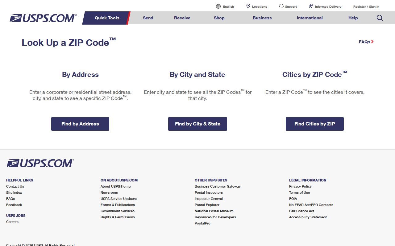
Its address form is a useful final check when a Nassau County postal locality conflicts with the town, village, or parcel label shown elsewhere.
ZIP+4 adds delivery precision below the five-digit ZIP. It is helpful for mail routing but does not change a parcel’s legal description or local-record custodian.
Nassau County Great Neck ZIP Codes
The 11020 through 11024 group is Nassau County’s clearest postal-geography example. Great Neck is a widely used community name, yet the official local landscape includes several villages and nearby North Hempstead areas. A Nassau County search that stops at a Great Neck postal name can miss the correct village record, or send a request to the wrong municipal office.
Start with the street address, use USPS to verify the postal locality, and then use GIS boundary layers to see the city, village, or unincorporated-area context. This extra step also helps when historic documents use a familiar community label that does not match a present legal field.
Nassau County ZIP Portal Limits
Official tools use ZIPs for different purposes. The New York voter lookup requires a matched name, date of birth, county, ZIP, and address information. It is not a public ZIP-wide voter list. A voter-file request under Election Law §3-103(5) procedures must state an election purpose, and protected addresses remain protected.
The New York sex-offender registry has ZIP as one of three mutually exclusive search modes, along with last name or county. Its public search is limited to the registry’s Level 2 and Level 3 framework, with a CAPTCHA and legal-use notice. It is a registry-specific result, not a count of Nassau County residents or an address directory.
The New York State Sex Offender Registry publishes the Nassau County ZIP search screen shown here.
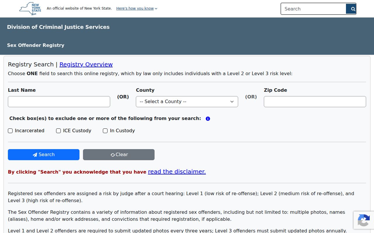
The one-choice search design is a reminder that matching rules differ by database and that a ZIP field does not create a general neighborhood list.
New York’s unclaimed-funds search also permits a city and ZIP refinement after a name search. It can help distinguish an old property claim, but it is not evidence of a current Nassau County address.
Note: A ZIP filter narrows an official search only when that particular source documents how it uses the postal field.
Nassau County ZIP Code Terms
Four address labels often appear in the same Nassau County record trail. Keeping them separate prevents a mailing field from being mistaken for a property or municipal field.
- ZIP
- A five-digit USPS delivery geography. It may cross village, town, city, or county lines.
- ZIP+4
- An added delivery segment used to sort mail more precisely within a postal zone.
- PO-box or service ZIP
- A code that may identify a postal service arrangement rather than a neighborhood. Research did not establish the purpose of every Nassau County combination.
- Carrier route
- A mail-delivery grouping. It is not a municipal boundary or a public list of households.
- Situs address
- The physical parcel location, which can differ from an owner’s tax mailing address and postal label.
Use the SBL and legal description when an assessment or deed search must distinguish parcels. Those identifiers provide a stronger bridge between Nassau County map, assessment, and Clerk records than a ZIP alone.
Nassau County ZIP Boundary Limits
A Nassau County ZIP code boundary is not a city limit. A ZIP may serve one village and an adjoining unincorporated area, while one village may use several delivery codes. The same road can cross municipal edges and retain a familiar postal community name. For local permits, records, and historical research, the right question is which custodian holds the address-specific file.
For records not posted online, Nassau County offers FOIL and records-request routes, while assessment cards, maps, valuation reports, and SBL letters have county fee guidance. Be specific about the parcel, street, municipality, date range, and record category. A narrow request reaches the right office more reliably than a broad request defined only by ZIP.
Note: Nassau County has no verified official ZIP split or realignment history in the research, so dated postal-change claims should be avoided.